
Project 2. Cloud-Precipitation Hybrid Regimes
Cloud Data
This project combines daytime cloud observations from NASA's Terra and Aqua MODIS instruments and corresponding precipitaiton from Integrated Multi-satellitE Retrievals for GPM (IMERG). On the cloud 2D joint histogram used in the previous “cloud regime” project, we add simultaneous observation of precipitation before the k-means clustering process. As a result, the full spectrum of cloud types AND corresponding precipitation intensity distribution are captured in a limited number of regimes.
Methodology
We apply k-means clustering to identify recurring patterns in the combined histograms of cloud (CTP-COT joint histograms) and precipitation. Utilizing the advantage of high spatial resolution of IMERG data (0.1-deg), first we collect simultaneous precipitation data using local passing time Terra and Aqua, and resulting 100 values in 1-deg (MODIS standard level-3 resolution) are transformed into 6-bin histograms based on precipitation rates. The concatenated histograms of cloud and precipitation are used for the k-means clustering process in the same way as described in the Project1-CR. We note that there are two versions of hybrid regimes depending on the weight of precipitation histogram: 1. natural addition of cloud (42-bin) and precipitation (6-bin) histograms resulting in total 48-bin histogram (referred to as “Pr6x1”), and 2. same weight between cloud and precipitation by duplicating precipitation histograms 7 times, resulting in total 84-bin histogram (referred to as “Pr6x7”).
Training Configuration
Training Period: June 2014 - May 2019 (5 years)
Horizontal Domains:
- Tropical domain: 15°S - 15°N
- Extended tropical domain: 50°S - 50°N
The five-year daily data from Terra and Aqua observations provides approximately 40 million samples for the tropical domain and 130 million samples for the semi-glbal domain, offering sufficient data to capture the general variability of clouds. The dual-domain approach allows examination of more detailed deep tropical convective systems.
Cloud Regime Characteristics
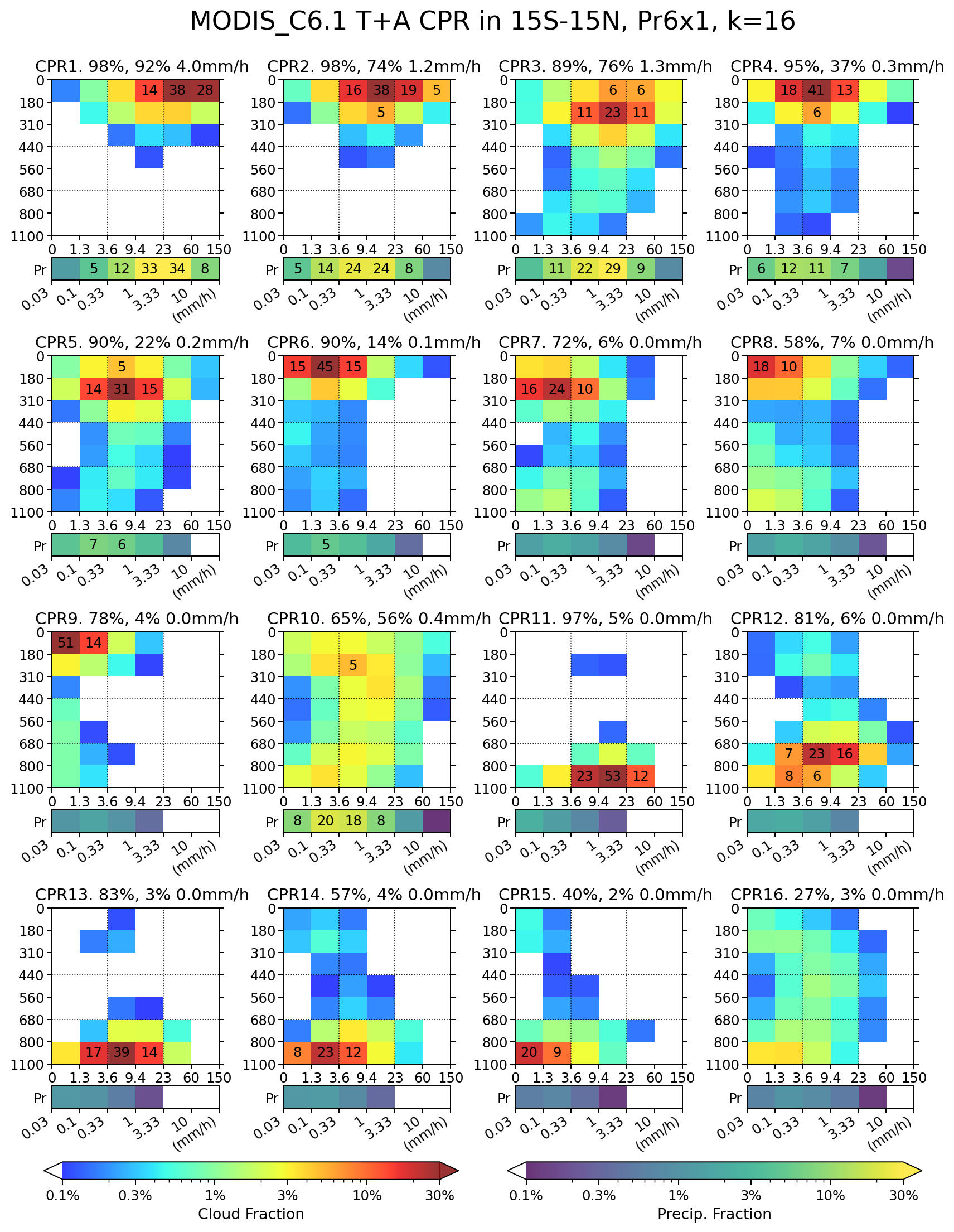
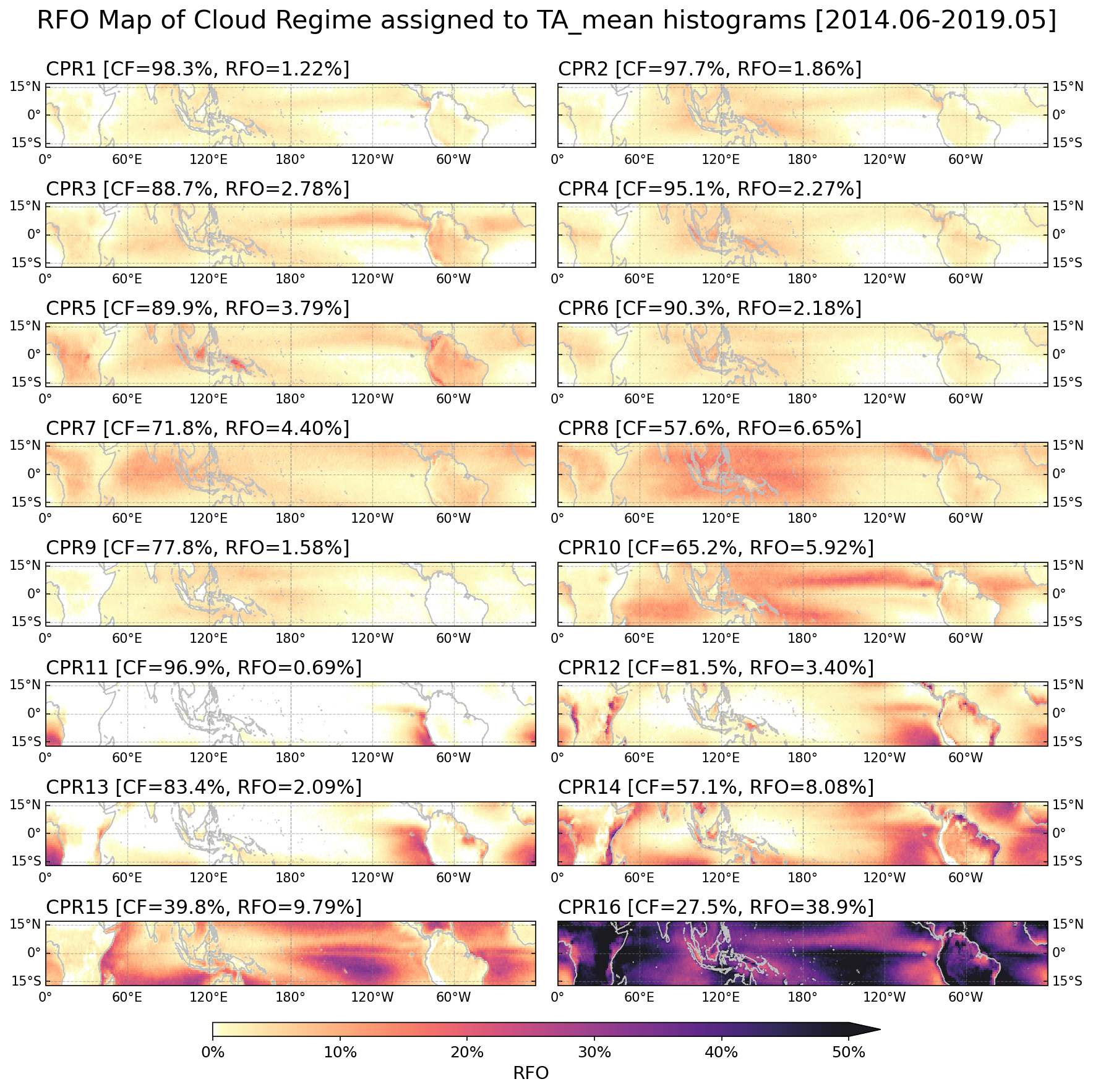
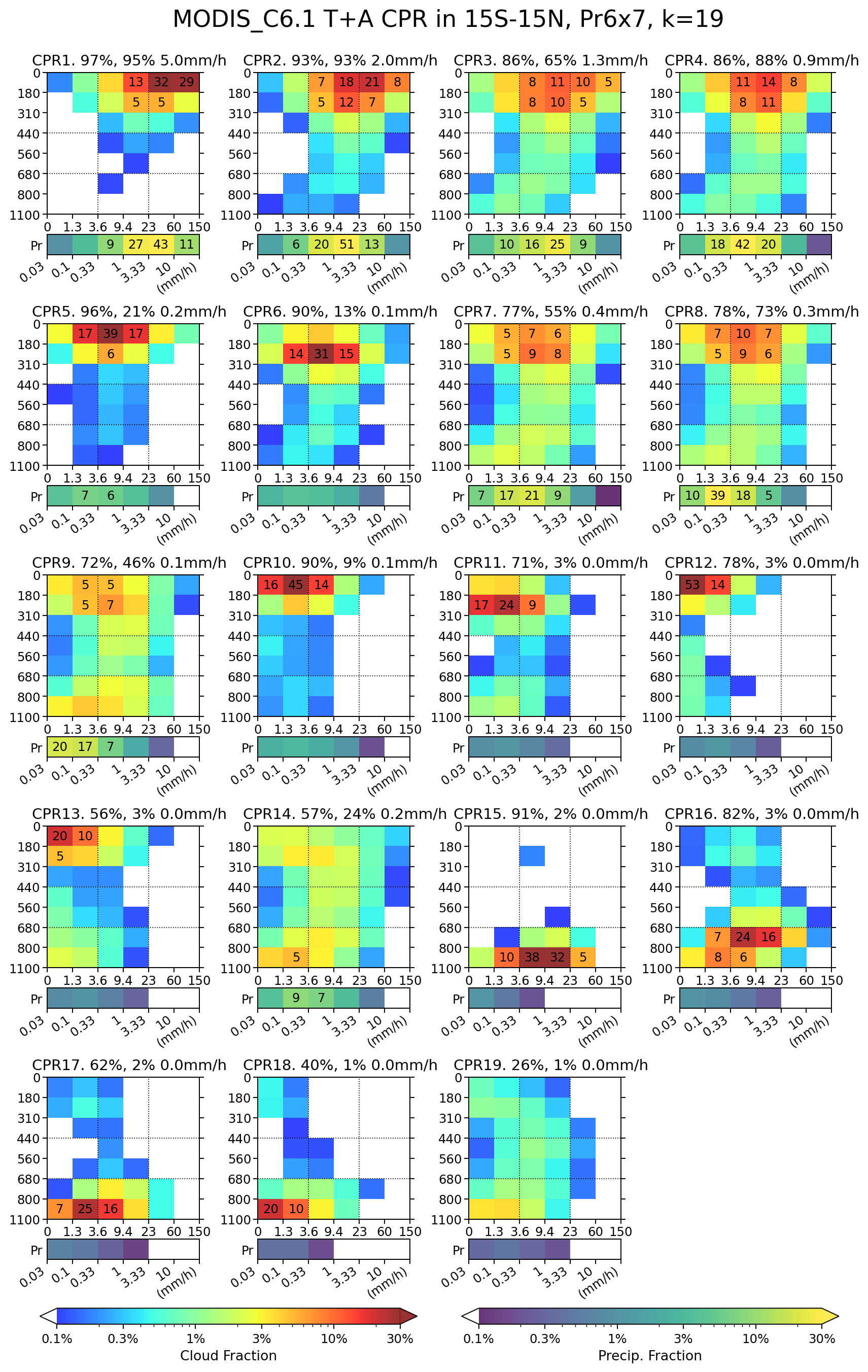
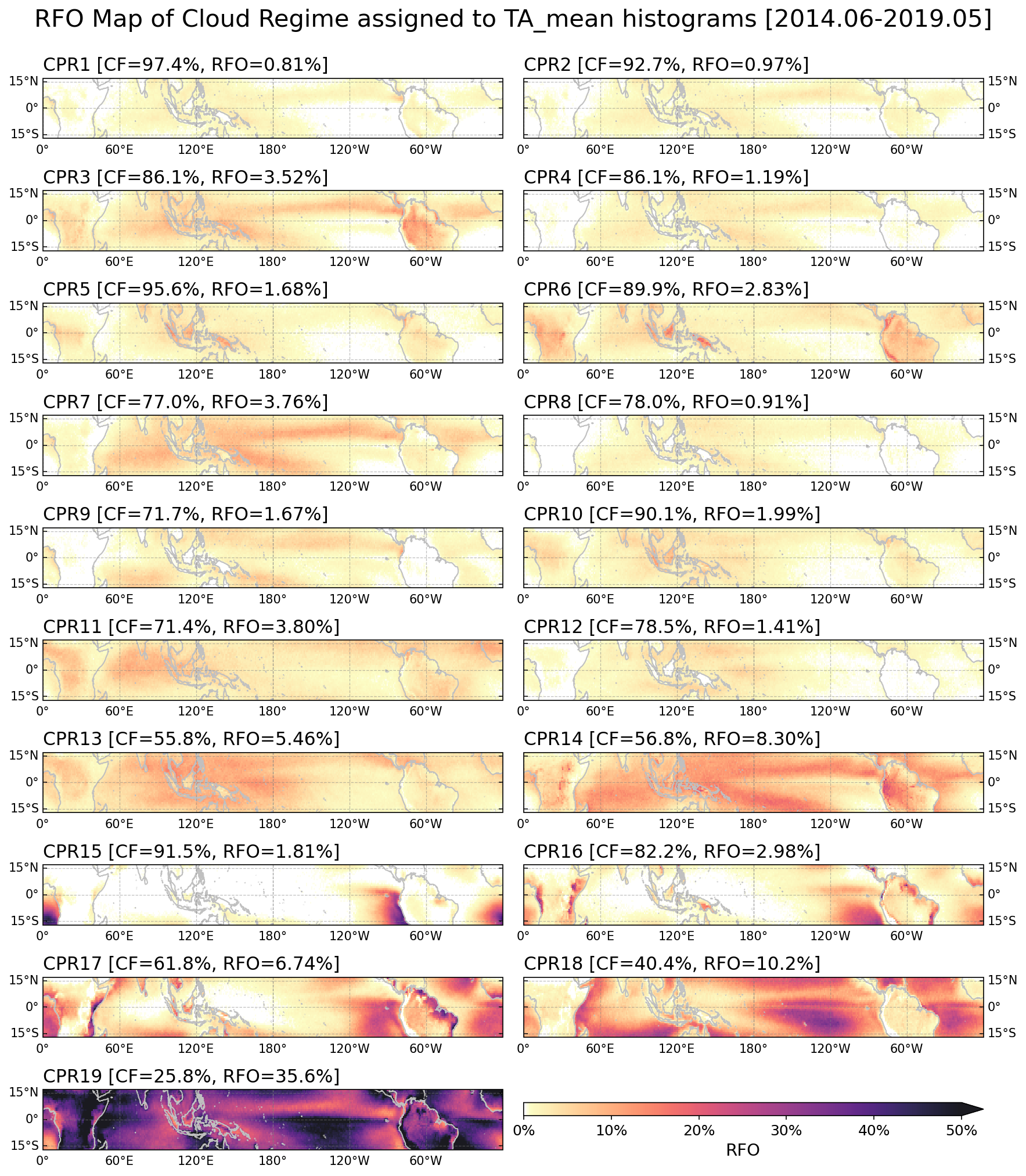
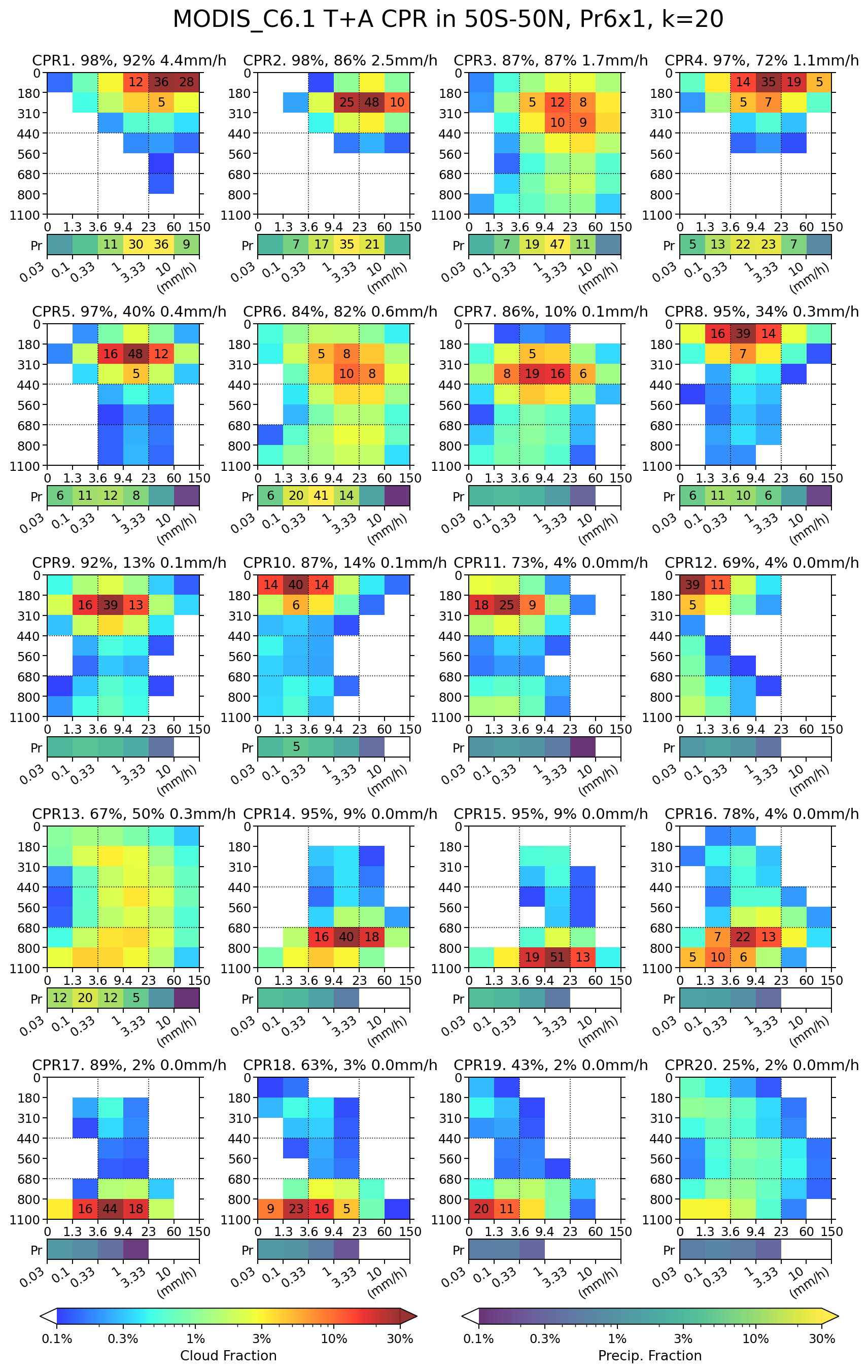
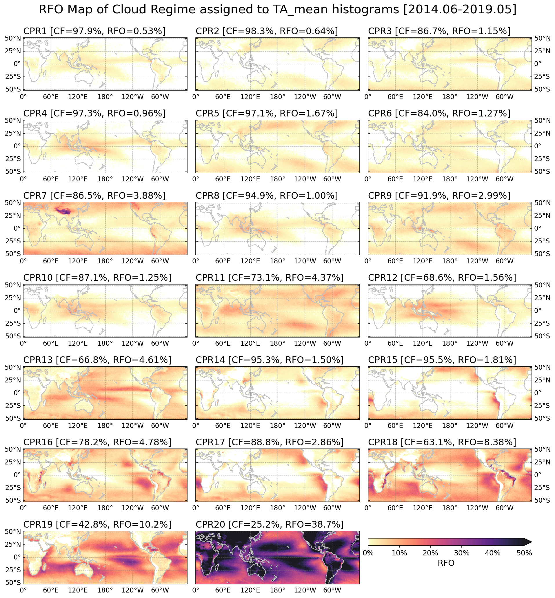
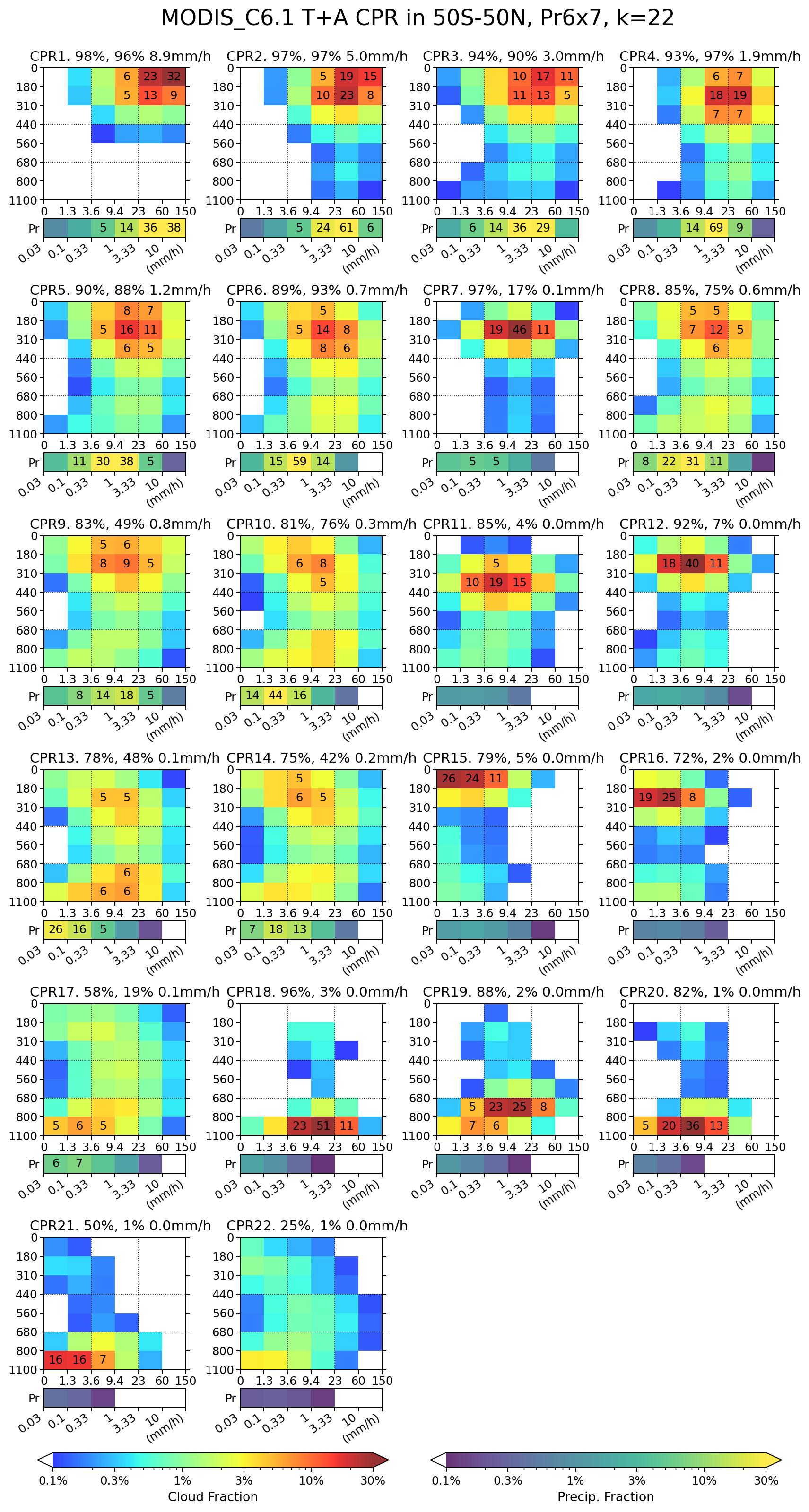
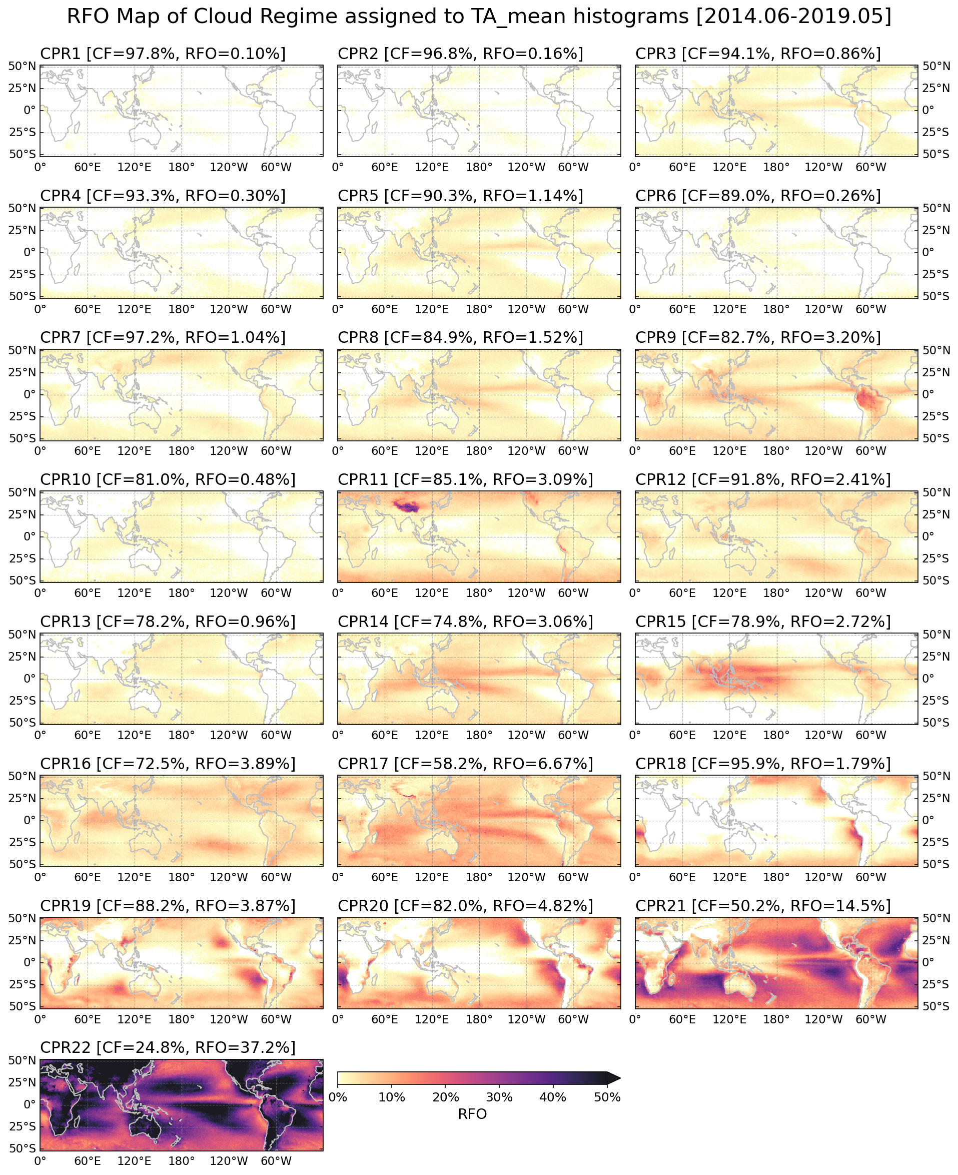
Extended Dataset
Using the centroids derived from the training period, we extend the cloud regime classification both temporally and spatially. The temporal extension covers the full MODIS data record spanning July 2002 to December 2024, providing a 22+ year dataset that enables investigation of long-term trends, decadal variability, and regime responses to climate modes such as ENSO and MJO. The spatial domain was also extended by 10 degrees in both the north and south directions, expanding coverage to 25°S - 25°N for the tropical domain and 60°S - 60°N for the extended tropical domain.
Projection of hybrid CPR into precipitation space
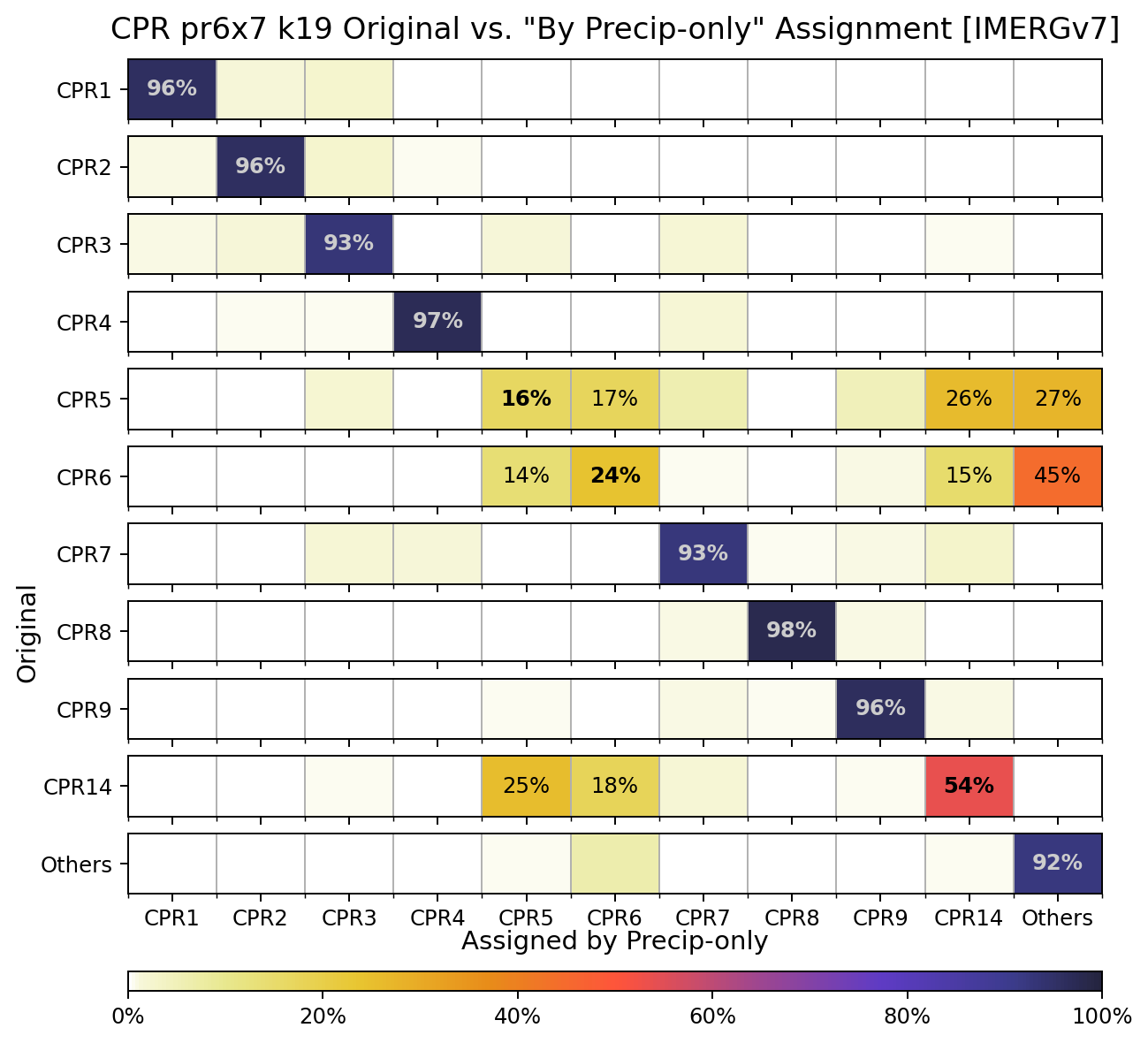
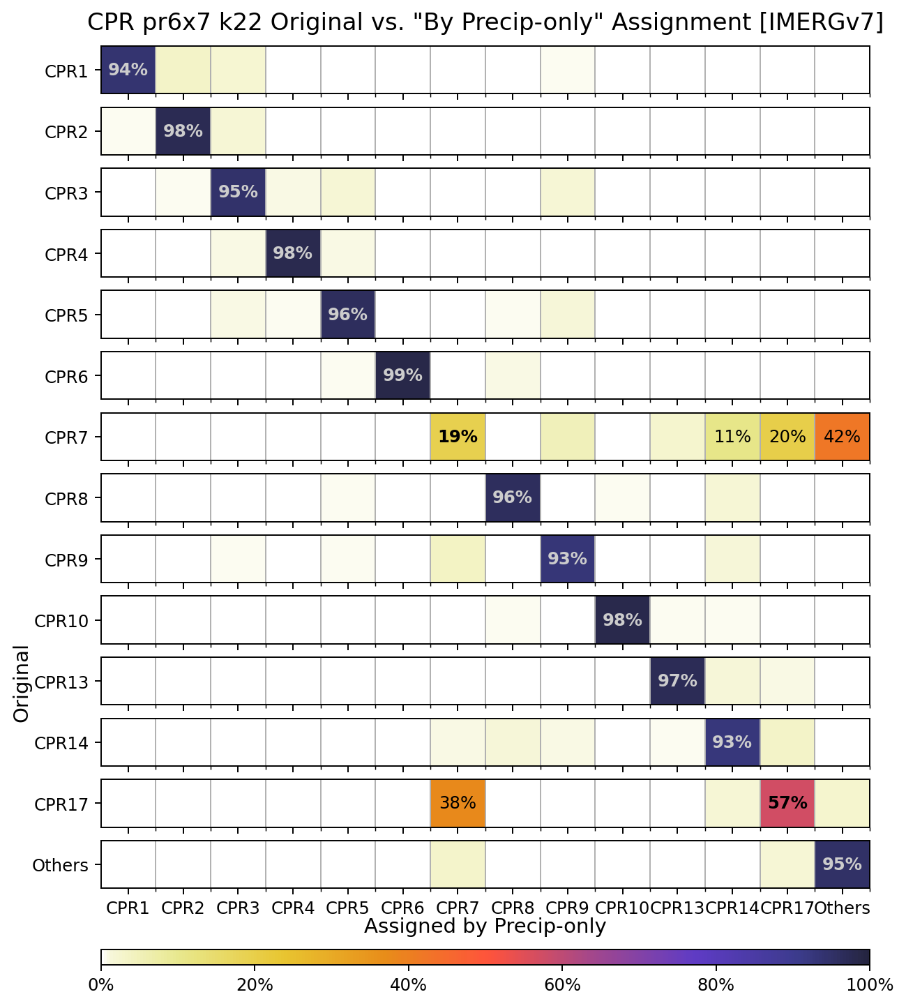
MODIS cloud observation is available at daily time scale, while IMERG precipitation data is available half-hourly. To take advantage of higher temporal resolution of precipitation data, we tested if we can identify hybrid CPRs based on only the precipitation. As shown below, the analysis suggests that convective regimes can be identified with precipitation-only, with high accuracy greater than 90%. Particularly for Pr6x7 set, several CPRs can be identified with precipitation-only data with >95% accuracy. It means that we can extend the daily CRPs to hourly resolution for convective regimes.
Data Availability: The complete cloud regime dataset is publicly available at https://zenodo.org/records/18356023
Reference: Jin et al. (2021), Journal of Applied Meteorology and Climatology, https://journals.ametsoc.org/view/journals/apme/60/6/JAMC-D-20-0253.1.xml